Photo: Rob Battersby
Walking out of the howling wind and rain with a friend (A.), we find shelter in the calm of the Open Eye Gallery with its soft lighting and airy, open plan layout (insert calm in the eye of the storm joke here). A. isn’t involved in the arts and hasn’t been to the Open Eye before, so I am particularly excited to hear her opinion on things.
We are immediately greeted with Corinne Silva’s ‘Garden State’, a series of small photographs of garden walls and borders displayed across three walls in a kind of abstract map. We spend a while looking at the individual images, and while we agree that they have a sense of beauty to them, there seems to be a discord between the images and their meaning. The wall text explains that these photos were taken across Israel and Palestine, and draw parallels between gardening and mapping as ways of dividing and allocating territory. It’s a great concept, but it doesn’t come across in the work, which on the surface, is just photos of gardens. As A. says – “something just doesn’t click”. Learning that they were originally published in a book alongside text makes me think that that would have been a much more appropriate format for the piece.
Looking down, we see Hagit Keysar’s ‘A Civic View From Above’ in the middle of the floor: a selection of aerial photos taken by community and activist groups using cameras attached to balloons and kites to form a large aerial view of the landscape. This is done so that these communities and activists can access a birdseye view of the contested areas, something that is restricted through technology like Google Maps. The topic is further examined in the piece ‘Anti-Mapping’, an ongoing project documenting contested territories. This is done through high resolution aerial photography which is then published in books that can be widely distributed. Four of these books are on display, and the wall text tells us that throughout the rest of the world the resolution on Google Maps is 0.5m²/pixel but in the area around Israel it is 2.5m²/pixel, significantly and intentionally blurring the territory, and making it difficult to document the changes over time.
Both of these works are fantastic examples of artists using their work and resources to instigate real change in the world, something that I think is a necessity if you are going to call your artwork political. It might then be questioned why these objects should be brought into a gallery space at all, but they’re actually a great educational resource, and while the ‘Anti-Mapping’ books can be widely distributed, it can also be useful to put copies in public spaces, like galleries where thousands of people can access them. As A. and I both acknowledge, we would have had no idea about the Google Maps restrictions if we hadn’t seen this exhibition (which is crazy), so the more people know about these issues, the better.
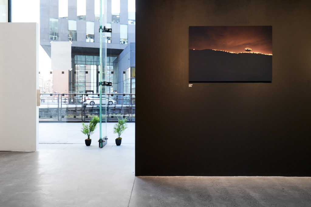
Photo: Rob Battersby
The second room around the corner displays the work of Tarek Al-Ghoussein and Yazan Khalili, both artists with links to Palestine (Al-Ghoussein has Palestinian parents and Khalili lives and works there). If ‘Garden State’ was too focused on aesthetics, and ‘Anti-Mapping’ too focused on function, then the works by Al-Ghoussein and Khalili are strongly situated in the middle ground. Al-Ghoussein’s series shows the artist interacting with the fading green mesh barriers used to mark ‘The Green Line’ – the 1967 border between Israel and Palestine. Khalili’s photographs were taken when he was stranded in the Palestinian town of Birzeit. While he was there there were significant power cuts, and the only light that could be seen was from towns across the border. While these works don’t have a function in the way that Keysar’s work and ‘Anti-Mapping’ do, they seem to have a strong educational value in the way the images alone draw you in and make you want to learn more. They are not only beautiful, but have stories behind them.
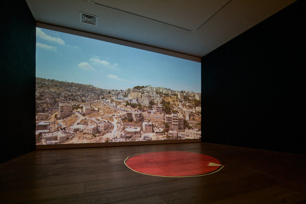
Finally, going upstairs (A. is a big fan of the lights on the staircase – “they’re giving me a headache but it’s worth it”), we find Hagit Keysar’s second piece ‘Restricted Zone: Temple Mount’, which consists of film footage of the artist flying a drone around Jerusalem to map the no-fly zone around Temple Mount, an area described as “the heart of political and religious conflict”. Watching this film (and thinking about her work downstairs) I am really reminded of Forensic Architecture and the ensuing debate around whether the work they produce can be considered art. Looking it up later, I realise that Keysar is part of Forensic Architecture so that makes a lot of sense.
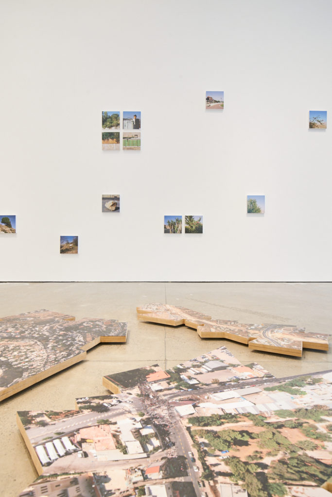
Photo: Rob Battersby
Afterwards A. and I agree that the exhibition was a fantastic educational resource, and led us to discussing all sorts of things from how governments can control drones, to questioning just how many of the cases in the exhibition didn’t make it to mainstream news sources here, and fundamentally, what can we do about it.
For me it also brought up the debate that is key to political art – function vs aesthetics. While we can go down the classic art student route and reference Duchamp (the idea that once you put an object in a gallery, it becomes art), I think it’s a much more complex debate than that. It’s no longer about what should and shouldn’t be considered art because surely we’re past that, but instead it is to do with the morality involved in using political struggles as an artistic resource. ‘Garden State’ for instance, while framed in a political context, doesn’t seem to do much to help those involved in the issues the artist is referencing. At the other end of the spectrum, Keysar’s work does the best it can to help with the struggles that are its subject, but then why does the artist choose to display it as art? I really don’t have the answers to this debate and neither does ‘Visual Rights’, but I think it does an excellent job of revealing a lot of different perspectives – whether or not this was the point of the exhibition.
Visual Rights in on display until 22nd March.
Filed under: Art & Photography
Tagged with: art, Corinne Silva, exhibition, Forensic Architecture, Hagit Keysar, Open Eye Gallery, photography, political, show, Tarek Al-Ghoussein, visual rights, Yazan Khalili
Comments